We’ve written before about Strava’s excellent use of data, and their new City Guides represent another fine addition to their suite of features.
The guides each include several curated routes based on popularity and frequency of riding, and will show you the best cycling the various destinations have to offer.
What’s included
Currently 12 cities are covered by the guides:
These represent some of the most popular cycling destinations in Europe, as well as a smattering of places further afield.
When you click through to a city there’s a short blurb, information on number of weekly rides and kilometres ridden by citizens and visitors, and a selection of routes based on these cumulative rides.
Riders of all abilities are catered for: the longest recommended ride is 193km (the Longue chevreuse in Paris), the shortest just 10km (the Central Park Loop, NYC). An example of a suggested ride in Milan, below:
When you click through to the ride you’re presented with the metrics (distance, elevation), an elevation graph, the usual red line showing the route, and little flags suggesting where to stop for coffee:
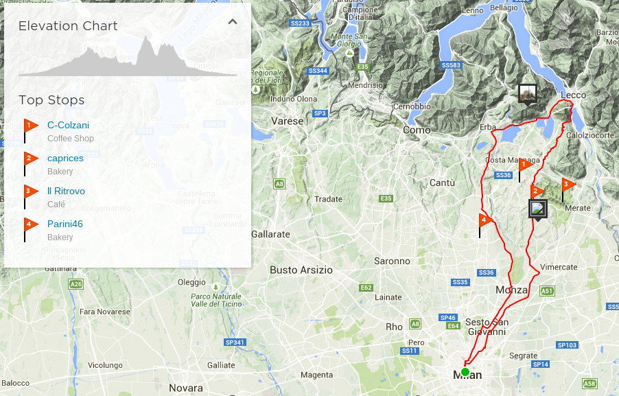
Clicking on a flag takes you to the Foursquare page for the recommended stop, giving you a chance to scope it out and see if it suits your taste.
Each guide also includes an image gallery to whet your appetite for exploration – some of the images are fantastic:
Data-powered
If you missed our Strava Labs post, here’s a bit of information about how Strava use their data for various purposes. Strava Metro is the best example of this process:
The cumulative data shows which routes people are choosing, how frequently they’re riding, how long it takes, where they’re stopping, and much more. Each ride is treated as a vote for a good route, and these guides combine aggregated rides with local insight to create useful suggestions.
And for any runners among you, running routes are offered too!