


Strava have launched a cool new feature on their site, called ‘Strava Labs‘.
The page is a hub of projects that people have made using the ever-growing dataset Strava maintains, comprising of all rides logged by its users. They come with the caveat that “these projects are independent of Strava and may be added, removed, or break at any time”. The data is anonymised before being added to the dataset, so individual rides (and riders) can’t be tracked; the privacy-conscious among you can rest assured!
Let’s take a look at the projects:
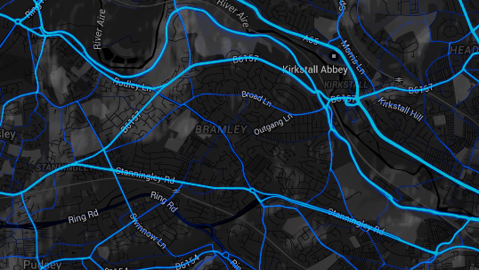
The project combines Strava’s data with the Google Maps API to create an interactive map showing all GPS points recorded. The more times a point (or route) has been recorded, the brighter it becomes. At a glance this lets you quickly see the most commonly ridden routes in your area; dig deeper and it begins to hint at the underlying reasons why some rides may be more popular than others.
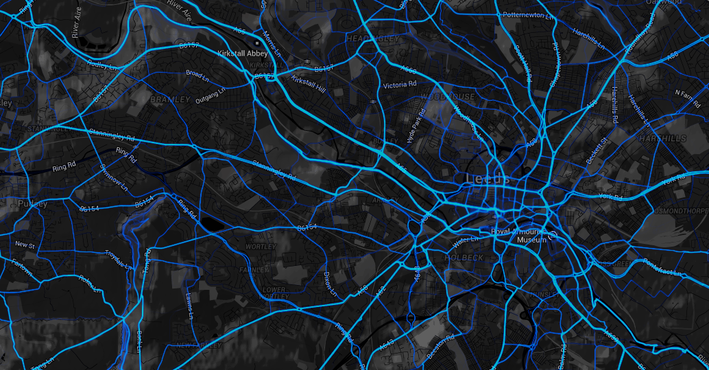
This shows the most common rides in and around Leeds
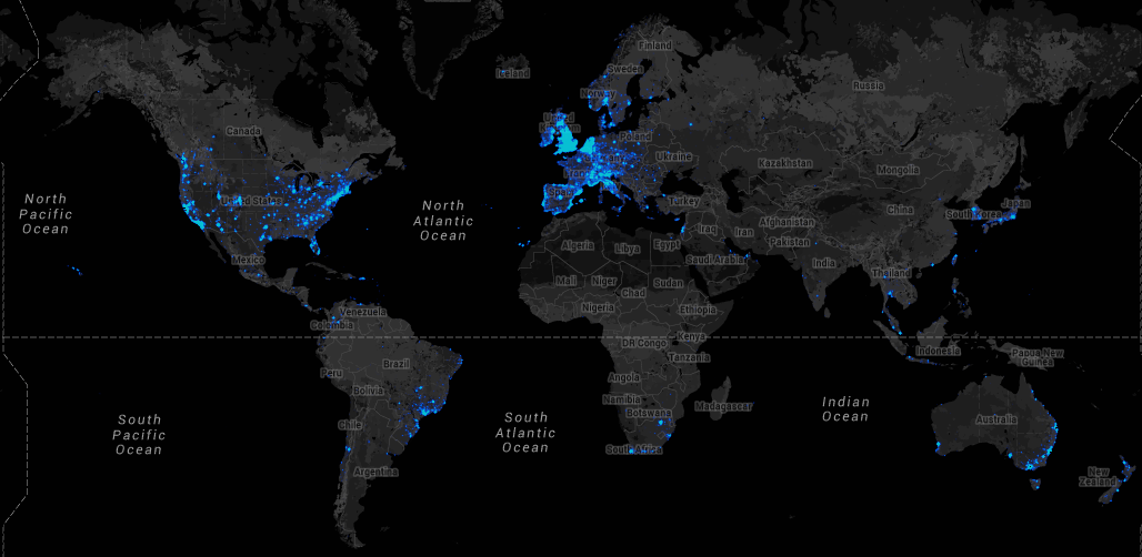
The world view is interesting: it shows where use of Strava is most prevalent
Strava says of the data, “activities [logged with the app] create billions of data points that, when aggregated, enable deep analysis and understanding of real-world cycling and pedestrian route preferences”. Their plan is to use insights from the data to “make cycling, running and walking in cities better”.
The democratic implications are fascinating: Strava say that logging rides is “a way for you to vote with your ride or run for better cycling and pedestrian infrastructure in your community”. The underlying logic is that more frequently ridden routes, or routes that individual riders repeatedly ride, are indicative of cyclists’ preferences, and that this information can be used to inform maintenance of existing and development of new cycling infrastructure.
The demographics of logged rides are interesting too, and perhaps not what you’d expect: “in denser metro areas, nearly one-half of [logged rides] are commutes”, and “most Strava cyclists do not refer to themselves as competitive”.
Full access to the dataset is available through Strava Metro (a more expanded version of Labs’ Heatmap and full Strava service, not part of the labs), although this is a paid service designed to be much more specific and granular. The data collected is more comprehensive than what is available through existing methods of collecting, and the tool can be used to evaluate the efficacy of changes as well as informing their initial adoption, meaning it has huge potential for advocacy groups, town planners, and other parties involved in implementing effective cycling infrastructure.
This project also uses frequency of data points as a vote of their popularity, this time through cross referencing stops of 5 minutes or more with Foursquare data to show the most popular stopping destinations for cyclists in a city:
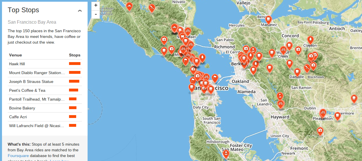
You’ll never be stuck for where to get the best lunch again
One of my more infuriating cycling experiences was when Google Maps led me down a chalky path which, due to recent rainfall, was completely unrideable. I picked up my bike and began what looked like a short walk past a farm and through a field, only to be followed for half a mile by the farmers’ mad, barking dogs (I had no idea if they were biters, and she was watching the whole time and didn’t call them off: quite threatening really!). The path stayed chalky, the puddles made it splashy, and my shoes (and entire legs) got increasingly muddy.
I finally got back to the road, only to find a 5 foot hedgerow between me and it which continued for at least 300 yards in each direction. No stiles were visible. So I walked one way, hoping to come across a stile, and when I finally did it was beside a smooth, tarmacked (and dog-free!) road that ran parallel to the cursed path I’d just taken.
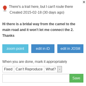
The moral of the story is that GPS based navigation apps aren’t always flawless, which is why this Strava feature fills me with great pleasure. Users can report and categorise errors, and people with the requisite knowledge can fix them: a inspiring use of community knowledge and spirit!
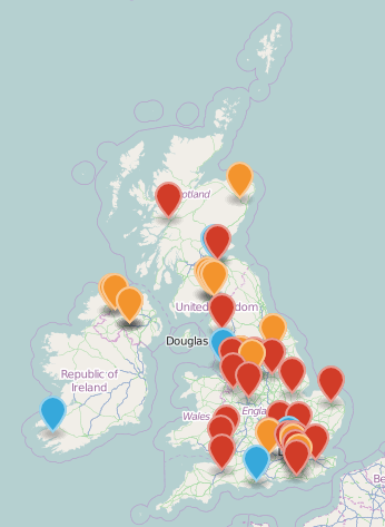
Errors in the UK
What the pins mean: Orange – route won’t go to road, red – can’t route on trail, purple – map info is incorrect, blue – other. I’m going to get in touch and suggest another colour: black for mad, barking dogs.
This tool ties into Open Street Map tool, and can be edited by anybody.
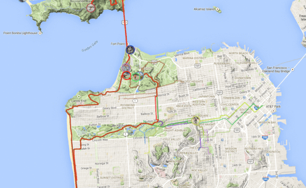
This project is really cool. It lets you replay routes by riders in your area in real-time, to see where they went, how long it took, and who crossed who’s path. There are currently only a few demo rides available, but its enough to show how cool the functionality will be. Given the level of information visible here, it’s likely that the tool will be opt-in, and that you’ll need riders permission to see their rides. It will be great for cycling groups to see how all their riders are doing.
This project shows achievements in your area. I don’t have any Strava achievements yet, so I’ll get back to you on this one!
This project also leverages the large data bank collected through rides logged by users, and aims to improve the Strava Mapping tool by bringing lines inputted by users closer to the real geographical route. It’s hard to explain with words, but the graphic below shows it well. The grey line has been entered by a user planning a route, the GPS data knows that the green line is what cyclists in the area actually ride, and the red line is the auto-corrected route.
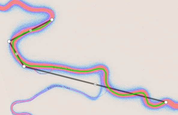
More accurate routes mean more accurate distances and elevation profiles!
It’s incredible to see this data being put to use, and the implications for all the projects are huge. More accurate and error free mapping is obviously great from individual users’ perspective, whereas the cumulative data may revolutionise the way cycling infrastructure is planned, justified and maintain.
We wonder whether the ‘best stops’ list will create a sort of filter bubble where people will go to the most popular place, making it more popular and perpetuating the cycle (if you’ll pardon the pun). Although similar criticisms can be made for review websites, guidebooks and any type of recommendation.
Google ran a similar labs project until 2011, where “more adventurous users can play around with prototypes of some of our wild and crazy ideas and offer feedback directly to the engineers who developed them”. It’s interesting to note that this is where two of Google’s most famous products (Google Calendar and Gmail) began their life.
Leave a Reply